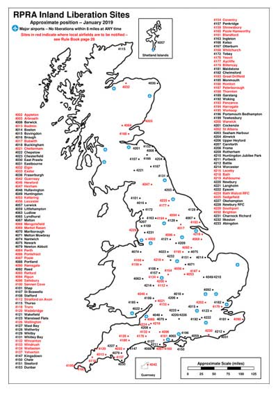
Up-to-date versions of both the UK and Continental liberation site maps, showing major airports and sites with airfield restrictions in the UK, are available to download by clicking on the appropriate image below.
 |
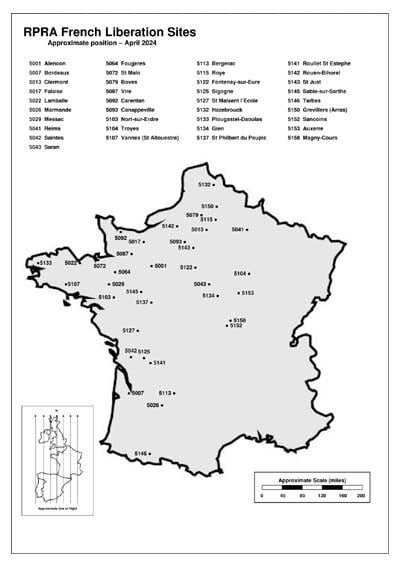 |
A3 size printed versions of these maps may be obtained free of charge from RPRA HQ by sending a large stamped addressed envelope. On the reverse of each is a chart showing the UK-France line of flight and ferry routes.
To order your copies please send your large SAE to RPRA, Unit 35-41 Upper Mills Trading Estate, Stonehouse, Gloucestershire GL10 2BJ.
N.B. As these maps are printed to order, they are right up to date to the day they are posted out.
You can also click the following links to see online versions in Google Maps:
UK Liberation Sites Map
Continental Liberation Sites Map


Comments are closed.