Distance Requests
CLUB SECRETARIES ONLY may apply for distances by e-mail to [email protected], quoting your Organisation No in the message subject box.
Your message must be laid out in the following format: lib site code comma loft number, on a separate line for each entry. For example,
4100,SW1234
4100,SW2345
4100,SW3456
4222,SW1234
4222,SW5678
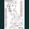
These may be sent either in the body of the e-mail, or as an attachment in text or Word format (not Excel). Full lists of inland, continental and Irish liberation sites can be seen here.
We usually return the distances to you the same day, or next working day, but please bear in mind the ever increasing popularity of electronic requests. You can help us to respond quicker by not sending numerous individual messages, but combining them into one request – the program can process thousands of distances at a time. Please do not send repeat requests, as this also slows the response time – your first request will be processed in due course.
Please note that this is an automated service and any other correspondence sent to that address will not be read. For correspondence on loft locations (but not applications) please contact [email protected] or telephone 01452 713529.
Alternatively, Club Secretaries may apply for distances via post – you can download the form here.
Individual members applying for distances must apply by post, as there is a charge of £3.00 per distance, plus return postage.
Loft Locations
There are three different methods by which members can apply for a loft location (the latitude and longitude of their loft):
- By submitting an Ordnance Survey map or map piece, clearly showing grid lines and grid line numbers, and pin-pricked at the loft position;
- By submitting a Google Earth print in the required format (see below);
- By submitting a Defra Magic Map print in the required format (also see below).
If you send us an OS map, please write the member’s name, loft number and date on the back of the map, which must be countersigned by a club official before you submit it to the RPRA Racing Support Office.
If you have a large map you might want to take a photocopy of the section depicting the loft. Please ensure that the grid lines and grid line numbers are clearly shown on the photocopy – if necessary you can write the grid line numbers on.
The guide to submitting a Google Earth print is downloadable here, and an example of a Google Earth print can be seen below. (Click on the image to download a sample print.) Please note that Google Earth is a free stand-alone program, and not a website – to download Google Earth to your computer follow this link. Google Earth produces GPS coordinates, which we convert to Ordnance Survey coordinates, so that all lofts are mapped on the same platform.
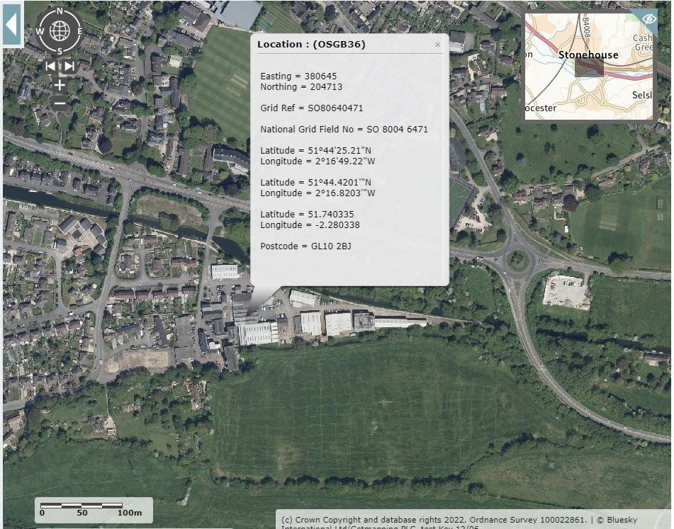
The guide to submitting a Defra Magic Map print is downloadable here, and examples of suitable prints can be seen below (click on the images to enlarge). Defra Magic Map can be accessed from this link.
 |
 |
In all three cases, there is a loft location fee of £6.00 plus return postage for your map and any distances you request at the same time. Please send us this in a cheque or postal order – we advise you not to send cash through the post, particularly coins, as this is often lost when passing through the post office sorting machines, and we cannot be held responsible for any loss. The loft location application form is downloadable here.
Please note – we do NOT accept loft location applications by e-mail. A pin-pricked map, Google Earth print or Defra Magic Map print, countersigned by the Club Secretary to verify the loft position, must be posted to us along with a cheque/postal order to cover the appropriate fees and return postage.
Club Radius
In the same way that we plot a loft location, we can also plot a club’s radius centre point. We then give this point a four digit code number, as we do a liberation site, and can provide precise distances from it to any loft. This service is free to clubs – just send us a pin-pricked map or Google Earth/Defra Magic Map print pinpointed to the appropriate location.


